Wednesday 28 December 2011

Bury Mead Springs 28th December 2011

Took my dog to the Bury Mead Springs conservation area today to blow away a few cobwebs.  Took one or two photos from the other side of the scrap yard.  There was an area of tree clearance right beside the River Hiz that I hadn't noticed before.  This is presumably where the final settlement pond will go before the run off from the viaduct enters the river after all oil and other polution has been settled out.

Looking south towards the scrapyard with the River Hiz on the right
 Same place looking east towards the railway

I moved further along to the open meadow and took the following shot of the now cleared Bedford line embankment.  An East Coast service can be seen behind on the main line.

 This is an older scan of unknown origin of the same embankment showing a DMU passing Gerry's Hole, having just crossed the Icknield Way.  The meadow hadn't been planted with trees at that time.  I am guessing this was the late '50s or early 60's as passenger services ended on 30th December 1961

Monday 26 December 2011

Latest photos

Took a quick look today at the progress around the work site.  Took a few photos of the latest developments.  First shows the relatively clear area along the former Bedford line embankment looking north from the scrapyard.  Didn't have time for a detailed look.
 I didn't want to go any further as there was an engineering gang working on the overheads on the main line as my next photo just about shows.

I then moved to the end of Wilbury Way and took a few more photos of the developments there.

Looking north towards the Icknield Way, the site has been fenced off and warning notices have gone up.  Although it is not easy to see, a new gate giving access to the sewage treatment works has been installed at the end of the far orange fence.  The second photo, taken from the same spot but further to the right, shows that the haul road has almost reached here.
 Moving round the corner into Hillgate, I took three more shots.  The first two show the partial fencing off of the site.

The final shot looks across to the point where the new line will join the existing Cambridge branch.  The existing embankment has been cleared of tree growth and the Stotfold Road bridge is clearly visible.  The fence posts are in now but the fencing has yet to go up.

Thursday 15 December 2011

Tree clearance complete

I had another look at the Network rail plans and on closer inspection the new line junction is further north from Cambridge junction than I first thought.  On that basis I think the tree clearance has reached that point.  I noticed a group of orange clad workers standing at the end of the cleared embankment as if they were checking the clearance work was complete.

For anyone who is interested the plans can be found here:-
http://www.networkrail.co.uk/aspx/6401.aspx

Also there is a video of a train drivers view of the new line:-

<iframe width="560" height="315" src="http://www.youtube.com/embed/f7fjjv4gxvw?rel=0" frameborder="0" allowfullscreen></iframe>

And an aerial view here:-

<iframe width="560" height="315" src="http://www.youtube.com/embed/cGF0YAiMpus?rel=0" frameborder="0" allowfullscreen></iframe>

Sunday 11 December 2011

Update Sunday 11th December

On visiting the site yesterday, I could see that the tree clearance had continued apace.  A huge number of trees and bushes have grown up unchecked since the final closure and lifting of the Bedford branch. 
I noticed that a large log carrying machine had been brought onto the site to move the increasingly large number of tree trunks that have been stacked up.
Now that the trackbed has been cleared, you can start to see a similar view to the pictures I uploaded earlier from 1964.  Although it is still hard to believe that this was once a very important section of line for the Midland Railway allowing them access to London.  For ten years this was a twin track main line from Leicester until the Midland fell out with the Great Northern and built an extension from Bedford to St Pancras.  Then from 1867 to closure it was branch line having largely been singled in 1911.  Even to this day the Midland main line is still referred to as the Leicester to Hitchin line.


 I then moved a couple of hundred yards south and took the footpath by the River Hiz under the bridge.  This photo shows the substantial three arch main line bridge with the lower arch of the Bedford line visible behind. In between is a later addition which I can't work out the purpose of.  Because of its semi-hidden location, there is a considerable amount of graffiti here.

Viewed from the other side, bridge two of the Bedford line is quite clearly visible for the first time for many years.  Quite a contrast to the other side as presumably the slightly later construction blocked the three arches of the main line bridge.  Note the odd mix of blue and yellow bricks.  The bridge is still in excellent condition which is a testament to the Victorian bricklayers that built it.
 Moving further away this shot shows more of the cleared embankment with blue netting along the far side of the Bedford embankment.  This is presumably to stop any tree fellers from straying on to the main line embankment as there no fence here unlike north of the scrapyard.
 Returning to my starting point, I took a picture of the other side of the scrapyard bridge, another substantial three arch blue brick construction.  One wonders why they are both so big when a single arch would surely have sufficed.
Finally, a shot east from the end of Wilbury Way of the haul road extending into the field along side the perimeter of the future embankment.  There was no evidence of this last week so preliminary works are moving ahead quite quickly.  Top left you can just see the edge of the main site compound.


Sunday 4 December 2011

Progress Report 4th December 2011

Apologies for a lack of an update last week.  A family illness prevented me from visiting the site until this weekend.  I could see from my workplace that work had commenced over by the scrap yard so I made that my first port of call.   The site had been fenced off from the bridge right up to triangle of land between the two embankments.   The first photo shows the site  notices that have gone up warning that this was a hard hat work site.  The second photo shows the tree clearance that has commenced looking South from the bridge.

I noticed that there were quite  a few other walkers passing through the site and exiting by the scrap yard.  A couple grumbled that their regular walk had been cut off by the works.  I decided to take a chance and grab a few photos from inside the site.  The fencing wasn't at all secure although I imagine when the actual construction (as opposed to tree clearance) starts it will be much more secure.  There will be plenty of vantage points where you will able to observe progress but these will involve a much longer walk from Ickleford via the Icknield Way.  I certainly won't trespass once this happens.


The usual workforce "comfort" facilities were in evidence although it appears that whoever installed them had forgotten their spirit level!


Clearance of elderberry and sloe trees that had thrived along the Bedford line embankment.


Logs piled up awaiting collection.  You can clearly see the level of the former Bedford branch with the main line behind.


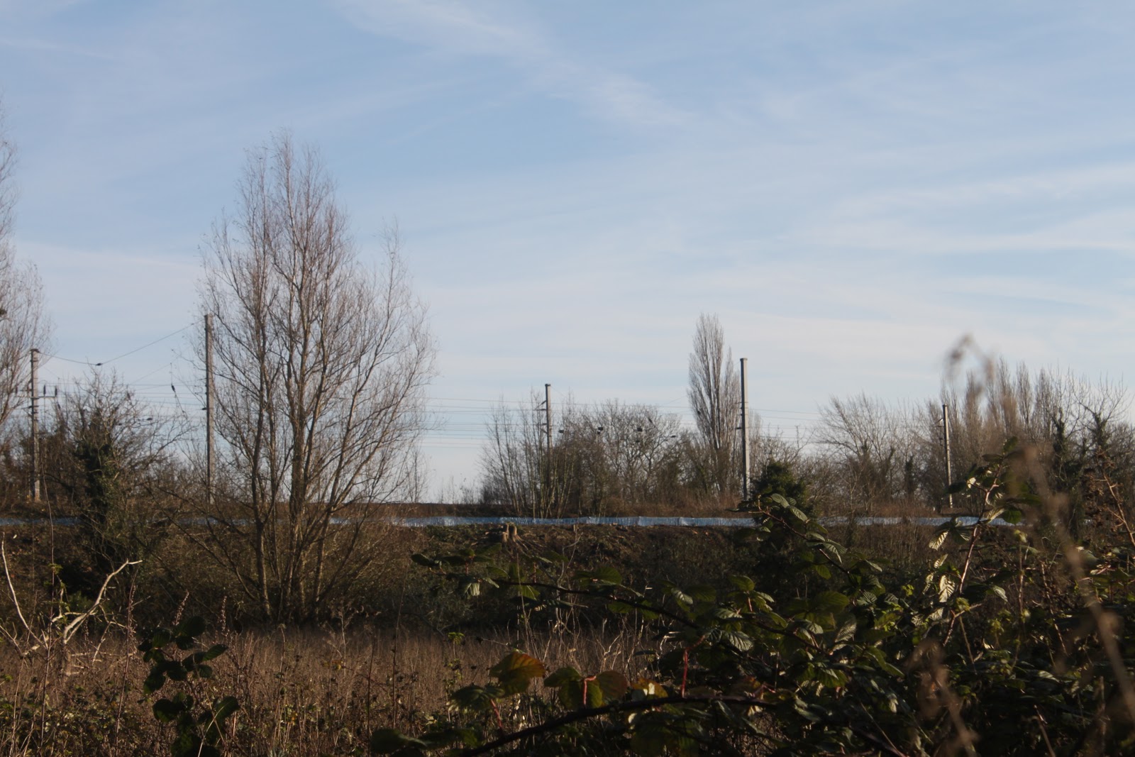
View towards the scrapyard from the embankment, a view that wasn't possible two weeks ago.

Finally moving up onto the triangle, a shot of the fenced off area where the viaduct will swing east over the main line.

I then walked to the Stotfold Road where the main site compound is being constructed.  I took the footpath that is shoehorned in between the Wilbury Way factories and the existing Cambridge branch line.  No evidence that this path is to be closed but it will have to be as it crosses the point where the new embankment joins the existing line.  I took a few more shots while I was there.

The first shot looks North towards the Icknield Way.  The new embankment will cross from left to right.

Looking East towards the new site compound.  The existing Cambridge line runs immediately to the right of the photo

 Moving closer to the compound, you can just make out the orange perimeter markers which denote the edge of the new embankment.

 Looking back towards the industrial area along the blue centre line markers which curve away to the right.


 The site compound well under way, soon to be ready to receive the estimated 170 lorry movements a day.  The speed limit on Stotfold Road has been reduced from 60mph to 40mph as a safety measure.  The road has been a notorious accident blackspot over the years despite several improvements.  Hopefully the compound has brought a welcome cash crop for the farmer! 


 Last blue centre line marker at the point where it meets the existing embankment.


Just for completeness, a view west towards Hitchin along the existing Cambridge line.  Shortly after the embankment ends, the line enters a deep cutting on the approach to Hitchin, followed by another embankment where it joins the main line.